


College
College of Engineering & Technology (Batten)
Department
Modeling, Simulation & Visual Engineering
Graduate Level
Doctoral
Graduate Program/Concentration
Modeling and Simulation
Publication Date
2023
DOI
10.25883/pep5-6d32
Abstract
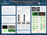
In the case of high density traffic flow, traditional traffic data statistical analysis methods, which not only have certain errors and lead to inaccurate data, but also have many limitations such as labor consumption, can no longer meet the demand for traffic analysis. Drones for traffic data, based on an aerial bird's-eye view, no offset, and error-free complete statistics of urban road shooting section of all data, while greatly reducing cost consumption. A multi-dimensional simulation model is established for the UAV data to the Hohhot central urban area's road simulation platform. This project will test and explore multidimensional data in the simulation platform to investigate the congestion problem in Hohhot's central city, as well as motor vehicle driving characteristics, non-motor vehicle driving behavior, road setting design, and other aspects, and provide optimization solutions for data-driven intelligent traffic control and management.
Keywords
UAV data, Traffic simulation
Disciplines
Transportation Engineering
Files
Download Full Text (1.2 MB)
Recommended Citation
Wang, Junqing; Yang, Hong; Zhu, Yuan; Pu, Qingwen; and Cui, Shunlai, "A Simulation Way to Investigate the Reason for Congestion in Urban——A Case Study in Hohhot China" (2023). College of Engineering & Technology (Batten) Posters. 1.
https://digitalcommons.odu.edu/gradposters2023_engineering/1