Using Planet Satellite Imagery to Map and Quantify Harmful Algal Blooms in Chesapeake Bay Tributaries
Description/Abstract/Artist Statement
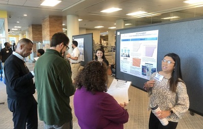
This project aims to utilize 8-channel Planet satellite imagery to map and quantify harmful algal blooms (HABs) within Chesapeake Bay tributaries. Satellite imagery is able to encompass a far larger area than conventional boat-based data collection, and the 3 m resolution of Planet is able to resolve spatial heterogeneity in HAB distribution.
We used a ratio between the red and rededge bands to construct a Normalized Differential Chlorophyll Index (NDCI). Chlorophyll concentrations were derived from this index using a Transformed Normalized Differential Chlorophyll Index (TNDCI) specifically created for shallow, turbid coastal environments.
Preliminary results show success in mapping extensive HABs. Retrieved chlorophyll concentrations aligned with corresponding in-situ data in both the York and Lafayette Rivers in 2021-2023. Satellite-based mapping enables quantification of total HAB area and biomass, which is unobtainable when making point-based measurements.
Planet’s high-resolution, high-frequency imagery captures the entire scope of coastal HABs and highlights areas where blooms may not be seen by traditional methods of data collection. Through the successful implementation of the TNDCI and its validation against ground-truth data, the project offers a promising framework for ongoing efforts to monitor and mitigate the impacts of HABs in coastal ecosystems.
Faculty Advisor/Mentor
Victoria Hill
Faculty Advisor/Mentor Department
Oceans and Earth Sciences
College Affiliation
College of Sciences
Presentation Type
Oral Presentation
Disciplines
Environmental Monitoring | Oceanography | Optics
Session Title
College of Sciences 5
Location
Learning Commons @Perry Library, Room 1311
Start Date
3-30-2024 12:00 PM
End Date
3-30-2024 1:00 PM
Using Planet Satellite Imagery to Map and Quantify Harmful Algal Blooms in Chesapeake Bay Tributaries
Learning Commons @Perry Library, Room 1311
This project aims to utilize 8-channel Planet satellite imagery to map and quantify harmful algal blooms (HABs) within Chesapeake Bay tributaries. Satellite imagery is able to encompass a far larger area than conventional boat-based data collection, and the 3 m resolution of Planet is able to resolve spatial heterogeneity in HAB distribution.
We used a ratio between the red and rededge bands to construct a Normalized Differential Chlorophyll Index (NDCI). Chlorophyll concentrations were derived from this index using a Transformed Normalized Differential Chlorophyll Index (TNDCI) specifically created for shallow, turbid coastal environments.
Preliminary results show success in mapping extensive HABs. Retrieved chlorophyll concentrations aligned with corresponding in-situ data in both the York and Lafayette Rivers in 2021-2023. Satellite-based mapping enables quantification of total HAB area and biomass, which is unobtainable when making point-based measurements.
Planet’s high-resolution, high-frequency imagery captures the entire scope of coastal HABs and highlights areas where blooms may not be seen by traditional methods of data collection. Through the successful implementation of the TNDCI and its validation against ground-truth data, the project offers a promising framework for ongoing efforts to monitor and mitigate the impacts of HABs in coastal ecosystems.


